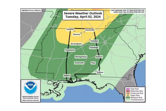
I’m not seeing a major outbreak type of setup for tomorrow, but we could see a few warnings. Just make sure you are weather alert and help spread the word. Make sure you have multiple ways to receive alerts. You can find lots of great information, like maps for Storm Shelter locations and information on how to program your NOAA Weather Radio on our First Alert Weather Day page.
The severe risk will be ending to the northwest by 8 p.m. Tuesday and by 9/10 p.m. this will mostly be a threat for areas south and east. The storms will end soon after midnight.

Sunshine will return on Wednesday, with highs in the 60s. It’s going to be a windy day, with northwest winds gusting to 30 mph. Dry weather will continue through the rest of the week and the weekend. We will need to plan for frost early Friday and Saturday, especially across northern areas. Unfortunately, it looks like the next system could start impacting the area on Eclipse Day Monday. Right now we have a partly to mostly cloudy sky in the forecast, with a 30% chance for showers