A powerful storm system moving through the state Wednesday and Wednesday night will bring chances of torrential rain, up to four inches in a 12-hour period.
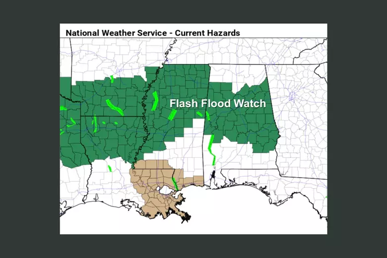
Central Alabama will be under a flood watch from noon Wednesday to midnight Thursday, with the advisory predicting rainfall amounts of up to three to four inches. Some spots could see as much as six inches, depending on the track and severity of some storms.
On Tuesday at 9:28 p.m., a warning was issued by the National Weather Service, valid from Thursday at 12 p.m. for Choctaw, Clarke, and Washington counties.
“At 29.0 feet, pastureland will become flooded. Livestock should be moved to higher ground for their safety. Old Ferry Road near the river begins to flood. At 40.0 feet, severe flooding of timber and pastureland. Portions of State Highway 114 in the east of the river become covered by water. Cabins on Old Ferry Road flood” explains the weather service.
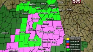
The entire state is at risk of severe weather, including possible tornadoes, and winds will flow up to 70 miles per hour, the National Weather Service office in Birmingham predicts. Areas in western Alabama near the Mississippi line, including the Tuscaloosa area, and areas of southwest Alabama will see higher threats of severe weather.
Meteorologist Gary Goggins from the NWS office said they could see a line of severe thunderstorms develop in the southwestern part of the state as the system moves through, he said. “Also, the energy could move farther north of us, and the possibility of severe weather could be less.”
The storms are expected to begin moving through the state at 1 p.m. to 6 p.m. in western areas, 3 p.m. to 8 p.m. in central Alabama, and 5 p.m. to midnight in eastern Alabama. Central Alabama is the bullseye for the heaviest rains, including the cities of Birmingham, Tuscaloosa, Selma, Montgomery, and Auburn. The area includes southeastern Alabama, including Enterprise and Dothan.
There is a chance that storms and showers will hang around into Thursday since the cold front won’t push through the state until midday Thursday.